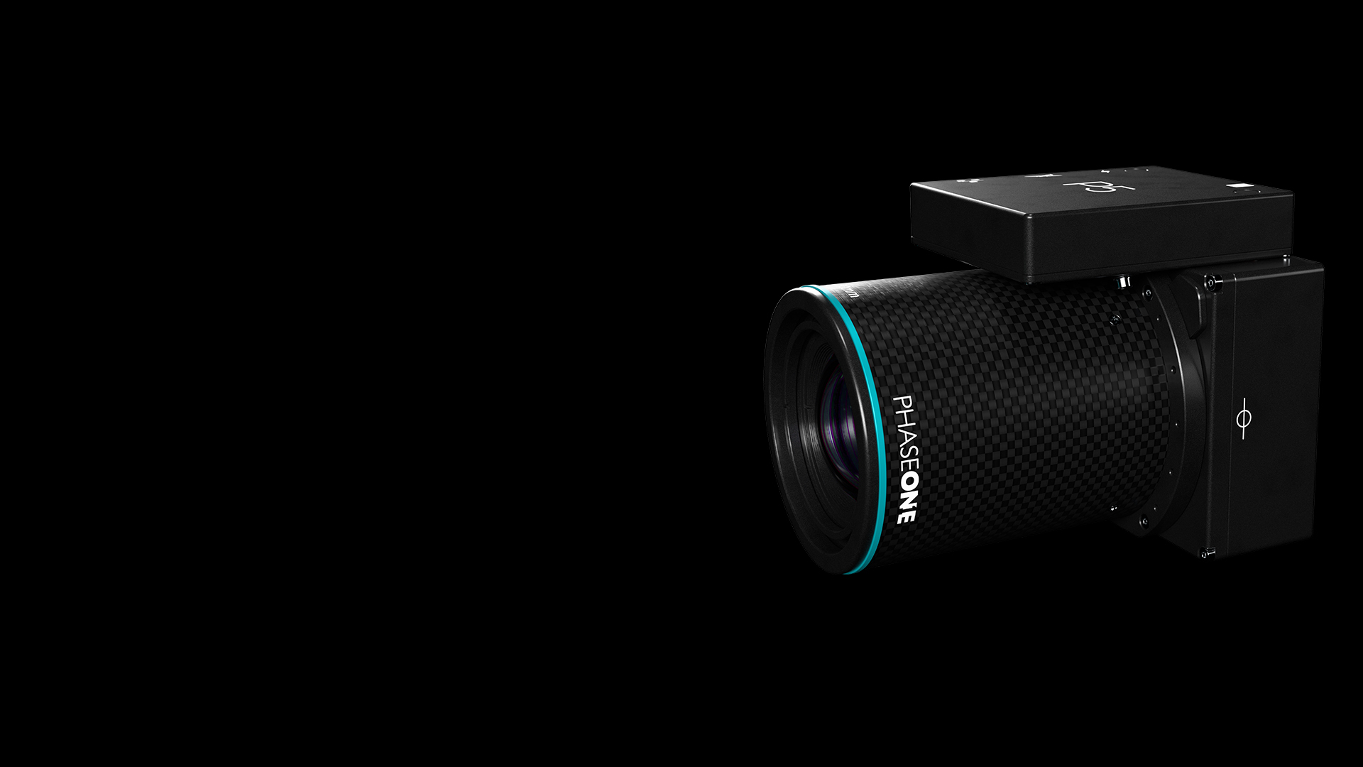
用于航空工程测绘的 P5有效载荷
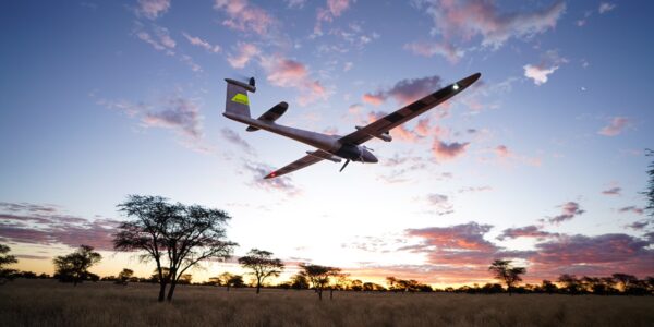
踏入工程测绘的未来,P5——这款革命性的无人机载荷,将重塑基于无人机的航空测绘格局。专为您的无人机量身打造,P5紧凑轻便,重量不足700克,且能耗低,是便携式、用户友好的迷你固定翼和过渡型无人机的理想之选。
P5提供灵活的安装选项,适用于陆地或走廊测绘,配备超高速1G接口和行业标准的MAVLink/Auterion通信协议,使无人机原始设备制造商(OEM)能够轻松提供行业领先的顶级载荷。
P5通过精密校准消除几何失真,并借助中曝触发功能实现100%精确的捕获时间戳,确保在不影响速度的前提下保障数据准确性。用户可从35毫米和80毫米镜头选项中选择,以实现更大覆盖范围和最低噪声,达到卓越的0.5厘米精度。其先进的1.28亿像素图像传感器可确保低地面采样距离(GSD)和无模糊图像,而电子全局快门则确保在任何条件下都能保持高性能。 选择P5,让您的航空测绘更上一层楼。
白皮书:Phase One P5相机系统——借助固定翼无人机实现测绘级精度
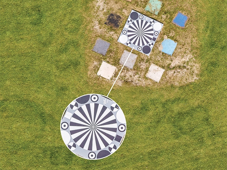
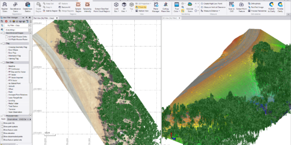
在工程测绘领域,实现地理空间数据采集的高精度仍是一项重大挑战。传统方法往往难以在X、Y和Z轴上达到所需的0.5厘米精度,而这一精度对于生成可靠的地理空间产品(如正射镶嵌图、密集点云和数字表面模型)至关重要。
为应对这一挑战,Phase One开发了P5相机系统,以与固定翼垂直起降(VTOL)无人机集成使用。本技术白皮书将基于在丹麦无人机系统国际测试中心收集的数据,探讨Phase One P5相机系统实现0.5厘米精度的能力。
探索 P5 载荷
使用P5,您将领略到精准与性能的强大力量,每一次任务都至关重要。拥抱无与伦比的精度,借助P5彻底革新您的工程测绘项目。
毫不妥协的绝对精度
P5是首款专为满足最高工程测绘标准而设计的无人机载荷。
- 无可比拟的精度,精度高达0.5厘米级别
- 经过测量级检校的相机,可消除成像畸变,实现超清晰图像
- 35mm、80mm 两款镜头选择,更大的覆盖范围,更高的精度
针对不同应用选择合适的镜头
80mm
- 窄视场经过优化,可实现更低的地面采样距离(GSD)并减少图像失真
- 非常适合高精度和天底点(NADIR)测绘/检查。
- 较窄的幅宽经过优化,可实现更高的精度
35mm
- 宽视场经过优化,可实现更大覆盖范围。
- 非常适合大面积区域和三维(3D)模型处理。
- 较宽的幅宽意味着在给定区域内所需的航线更少。
可靠的数据捕捉
P5的卓越性能得益于其先进的1.28亿像素图像传感器,该传感器可确保实现极低的地面采样距离(GSD)。
- 更快、更精准的地面点选取
- 低镜头畸变,像素失真程度小于 1 px
- 采用电子全局快门,更高的快速帧率,每秒可拍摄多至4张图像,适用于高速飞行大、比例尺高的重叠图像
专为市面现有无人机而量身打造
P5专为现有无人机量身打造,结构紧凑、重量轻盈且功耗低,是便携式迷你固定翼无人机和过渡型无人机的理想之选。
- 旨在为现在测量人员提供端到端解决方案
- 支持市售小型固定翼和混合翼无人机
准备好 执行任务了吗?
欢迎使用我们的GSD计算器, 这是专为追求精准的航空成像而设计的必备工具。
了解您的GSD,有助于您优化无人机的图像质量和飞行任务,确保测绘项目取得最佳成果。
P5 fulfils a realm of applications efficiently, like no other UAV payload in the market
Applications
The P5 UAV payload is designed to tackle a wide range of industries and applications with unmatched efficiency and precision. The P5 delivers the accuracy and adaptability needed for high-impact results across industries, all in one powerful tool.
Surveying & Infrastructure
- Land Surveying: From traditional practices to compliance and crack detection
- Roads & Railways: Corridor mapping, condition monitoring, and signal box analysis
Industrial Applications
- Mining & Quarrying: Pit mapping, geology, haul road analysis, and fragmentation studies
- Construction: Precision monitoring and design compliance
Environmental & Agricultural Insights
- Environmental Management: Coastal mapping, erosion analysis, and disaster response
- Agriculture: Plant counting, water management, and large-area mapping
Aerial Mapping & Asset Management
- Supports 3D mapping, insurance-related monitoring, and infrastructure maintenance
Technical specifications
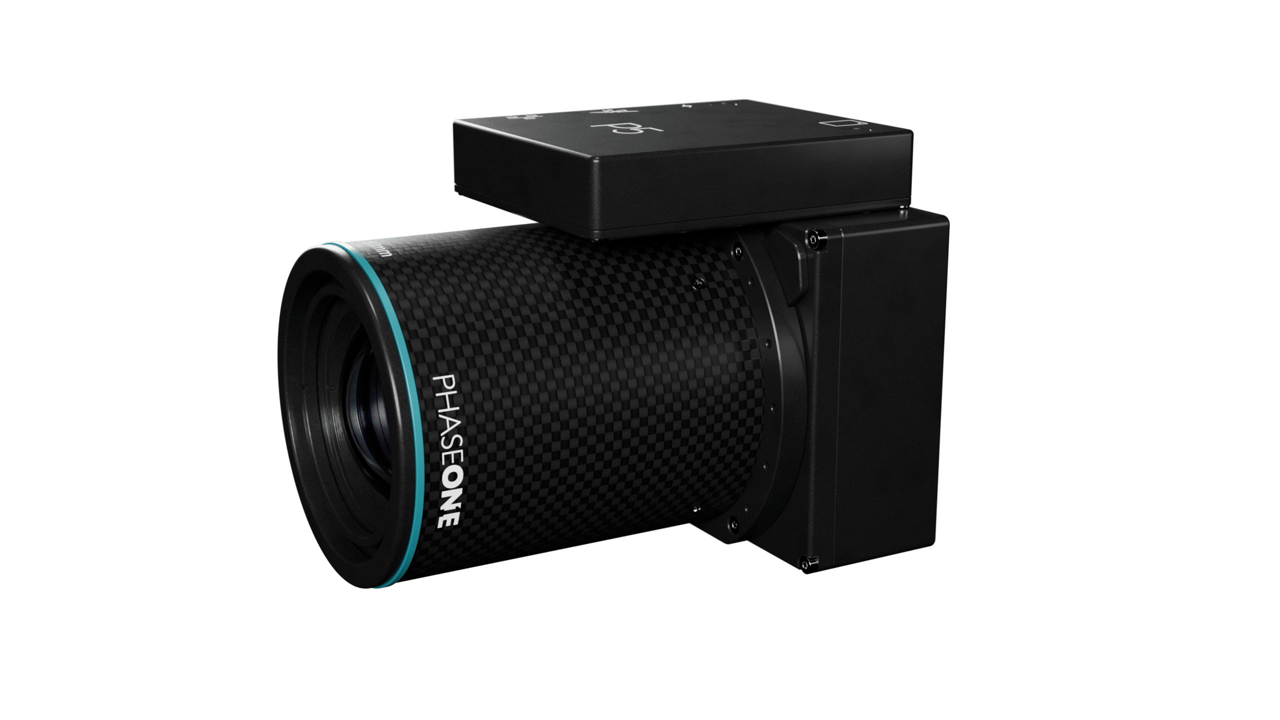
Image Sensor & Camera
Sensor resolution (MP)
128 RGB
Sensor resolution (MP)
128 RGB
Sensor type
CMOS
Sensor type
CMOS
Shutter type
Electronic global shutter
Shutter type
Electronic global shutter
Frame size across track (long side, pix)
13,468
Frame size across track (long side, pix)
13,468
Frame size along track (short side, pix)
9,564
Frame size along track (short side, pix)
9,564
Pixel size (u)
3.45
Pixel size (u)
3.45
Dynamic range (dB)
80
Dynamic range (dB)
80
Light sensitivity (ISO)
200 - 6,400
Light sensitivity (ISO)
200 - 6,400
Max. shutter speed (sec)
1/16,000
Max. shutter speed (sec)
1/16,000
Recommended max. operational shutter speed (sec)
1/10,000
Recommended max. operational shutter speed (sec)
1/10,000
Max. frame rate (fps)
4
Max. frame rate (fps)
4
Weight & Dimensions
35 mm
± 690 g / h: 11.8 w: 9 b: 9 cm
Weight & Dimensions
35 mm
± 690 g / h: 11.8 w: 9 b: 9 cm
80 mm
± 620 g / h: 12.5 w: 9 b: 9 cm
80 mm
± 620 g / h: 12.5 w: 9 b: 9 cm
Contact a Phase One Expert
If you would like to learn more about our P5 Drone Payload Solution, our experts are eager to help! Contact Us.
